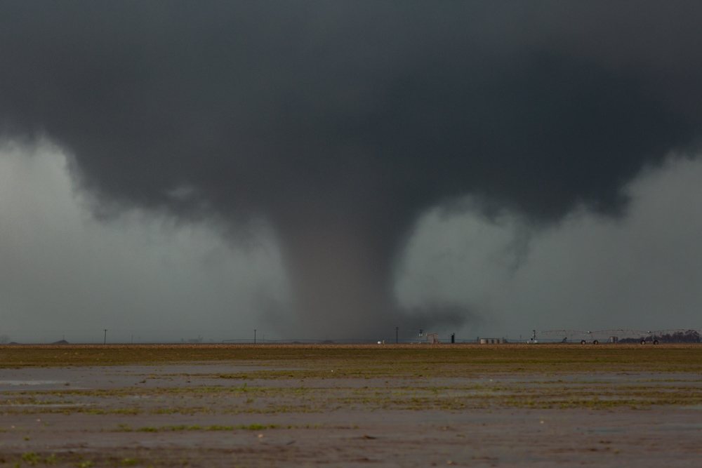
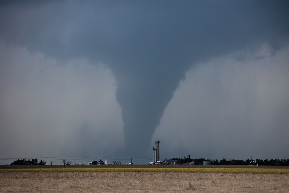
Stove Pipe Tornado
A large stovepipe tornado near Perryton, Texas
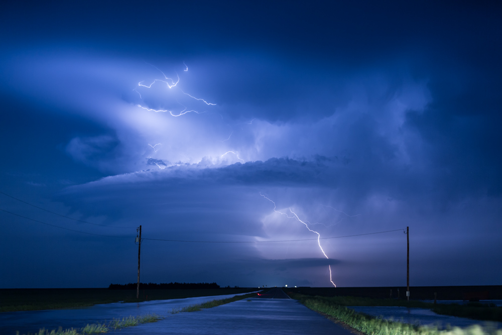
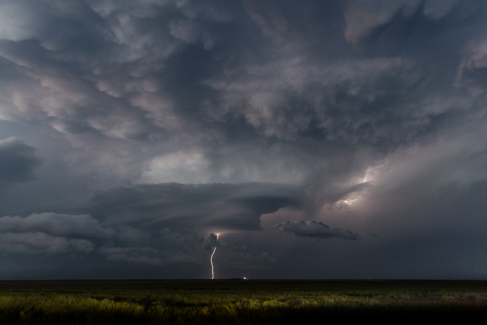
Supercell Lightning in Logan County Kansas
Supercell Lightning in Logan County Kansas
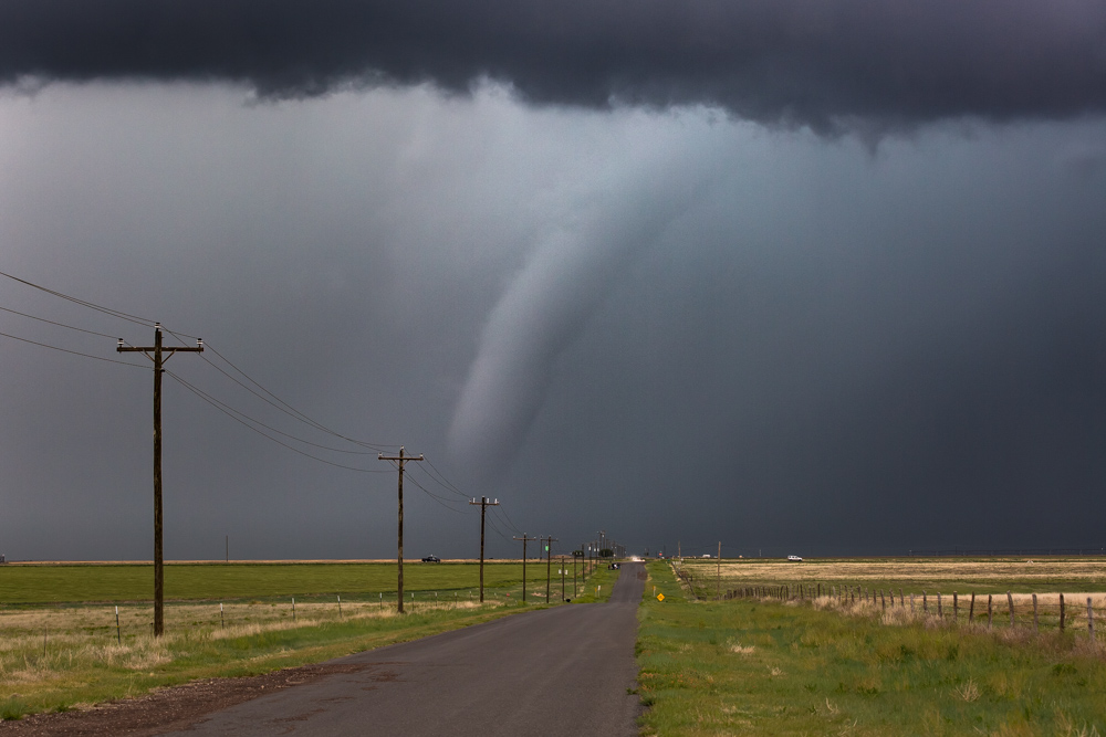
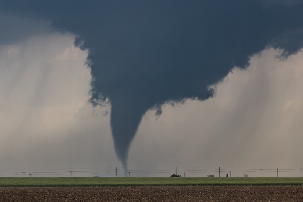
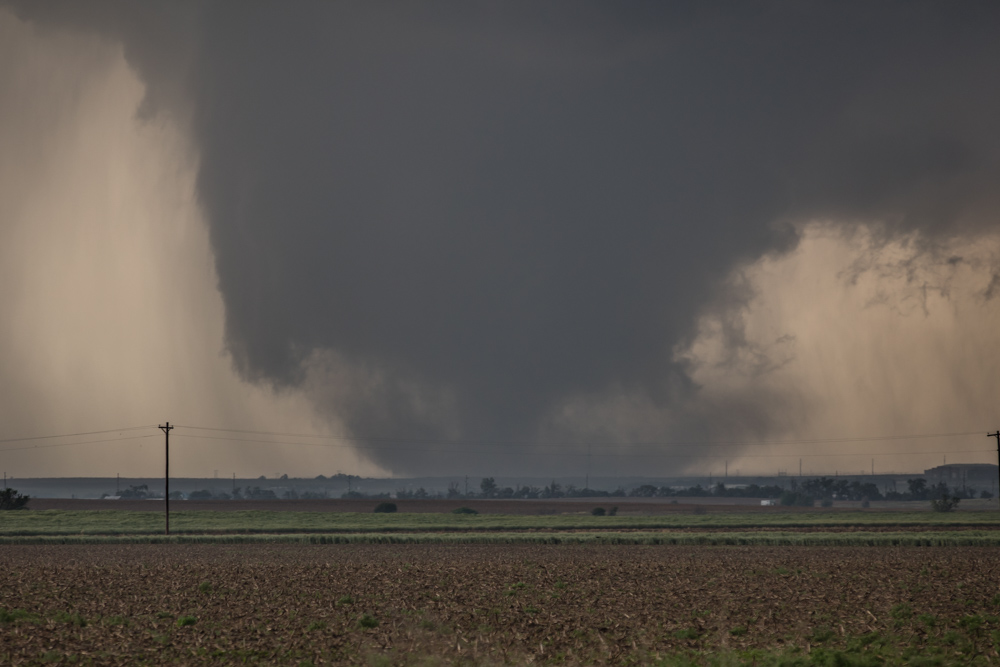
Tornado near Felt, Oklahoma
Tornado near Felt, Oklahoma
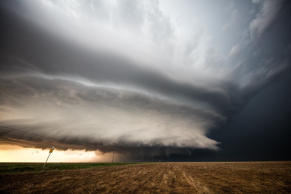
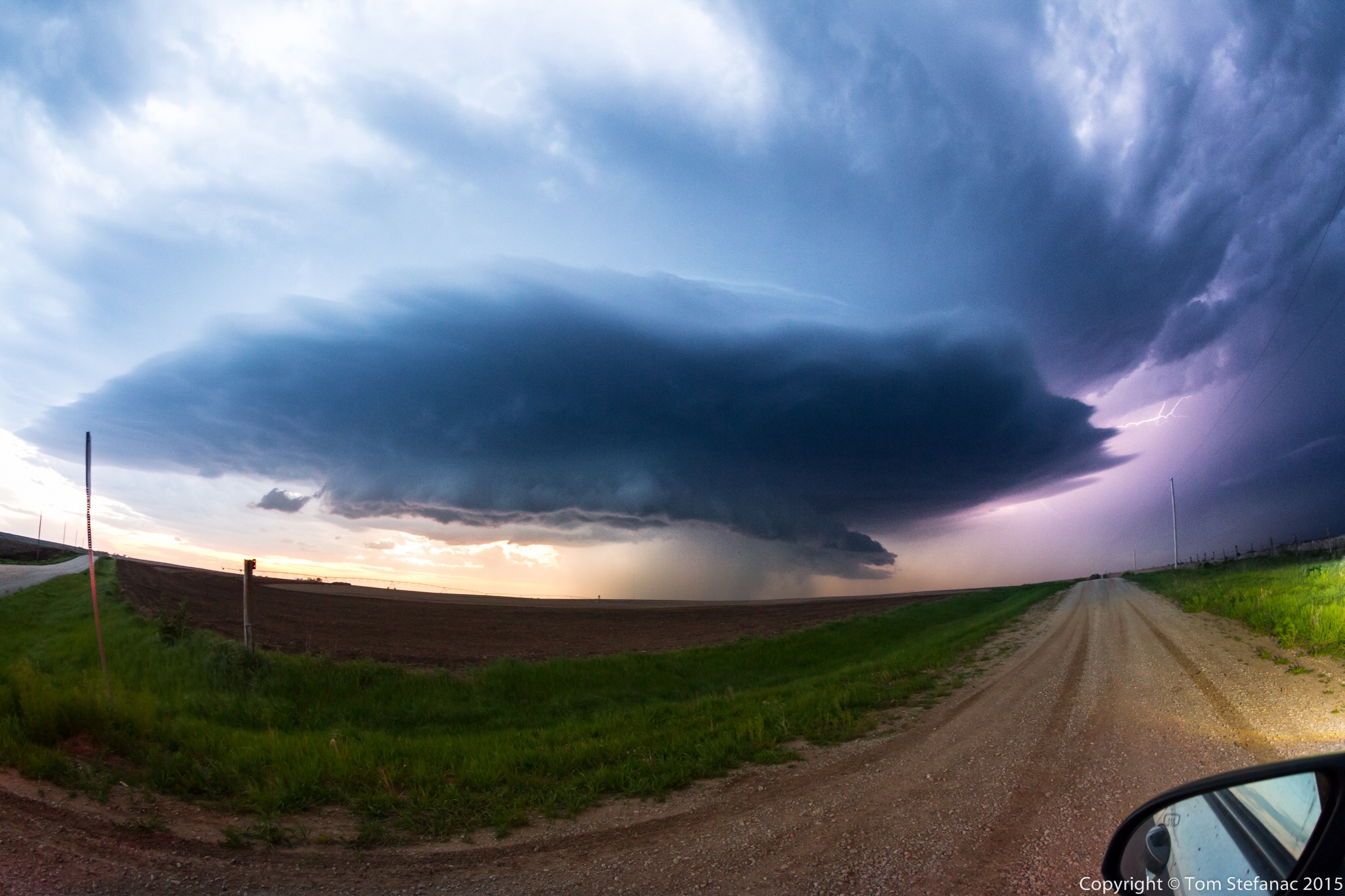
Leoti Kansas Supercell
A majestic supercell near Leoti Kansas
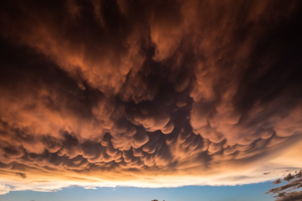
Sonora Texas Mammatus
Sonora Texas Mammatus
Cone Tornado
Cone tornado near Dodge City Kansas
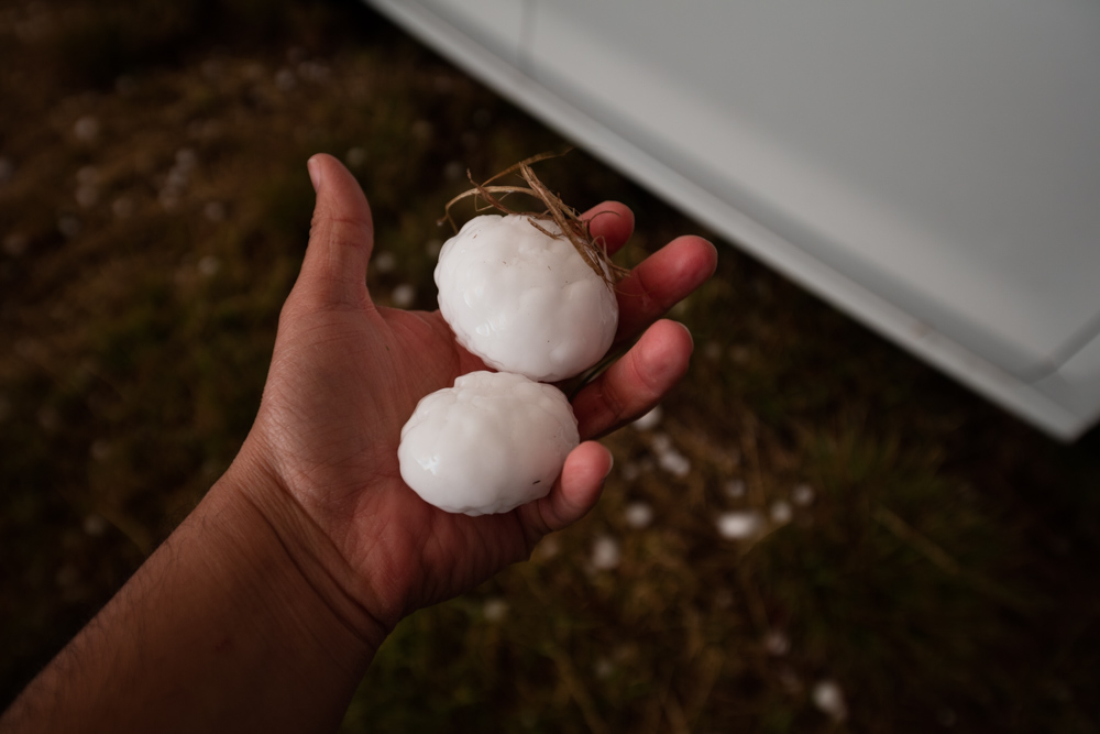
Large Hail near Masterson, Texas
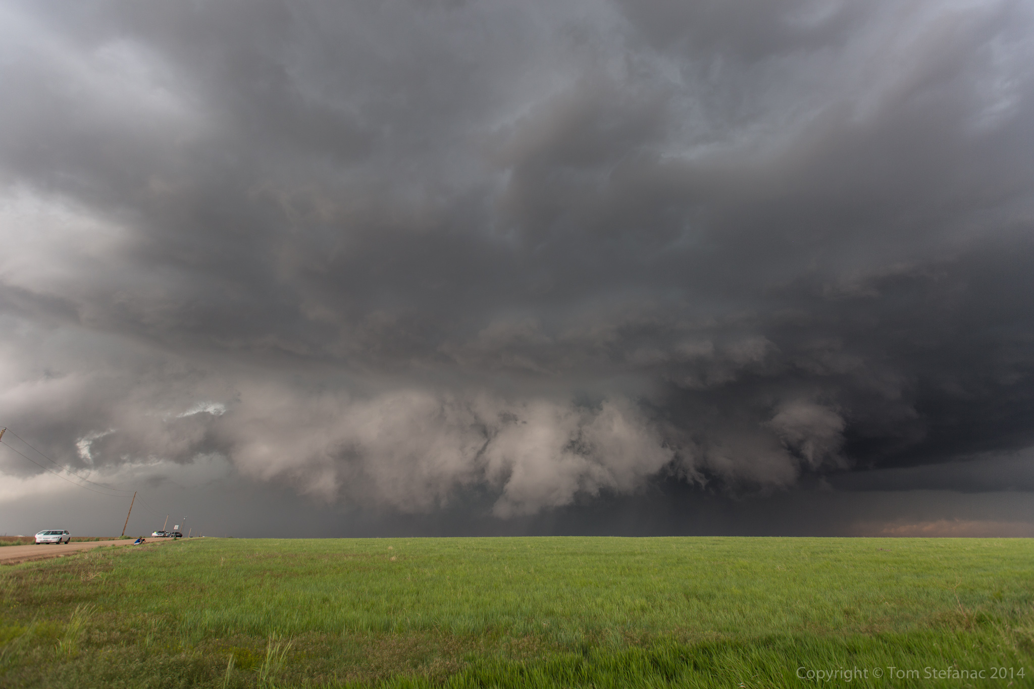
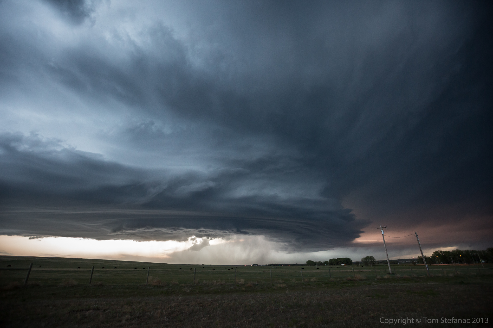
Ground Hugging Wall Cloud
A rare high precipitation supercell produces a ground hugging wall cloud near Bennett, Colorado
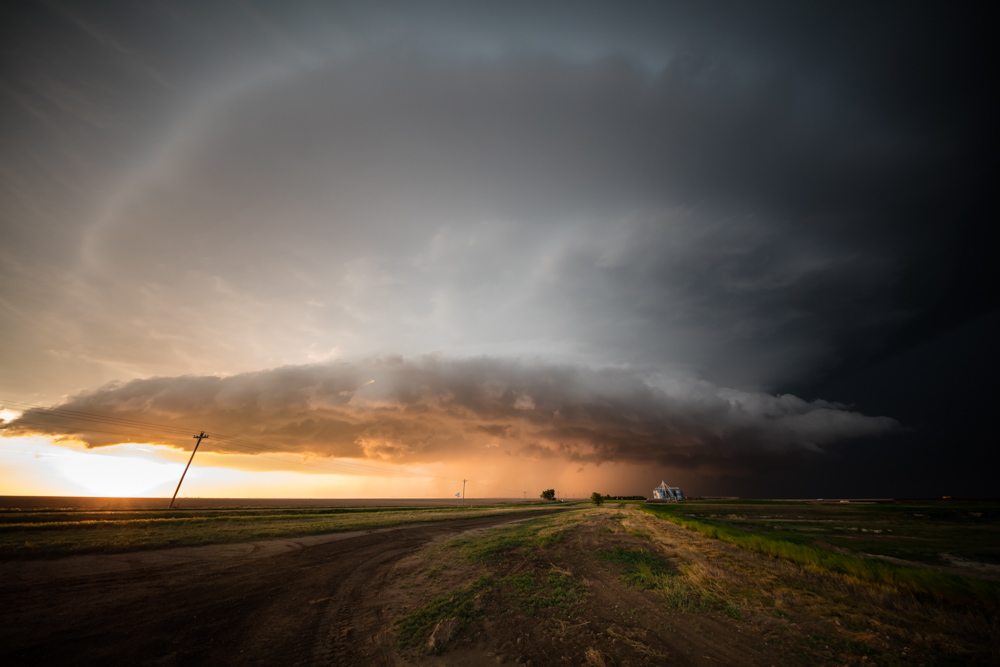
Kansas Tornado
Leoti Supercell Lightning
Classic Supercell
A classic supercell thunderstorm near Lincoln, Nebraska
Kansas Supercell
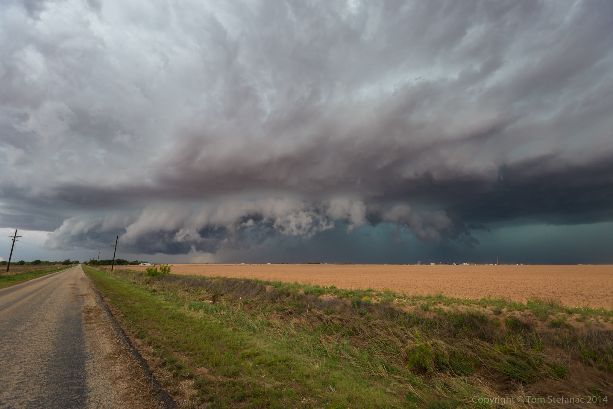
Big Spring HP Supercell
Powerful high precipitation supercell with a rain wrapped tornado north of Big Spring, Texas
Big Kansas Tornado
Dumas Texas Supercell
Extremely cold but powerful west Texas supercell near Dumas
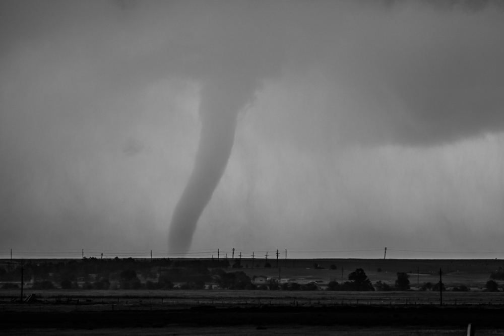
Stove Pipe Tornado
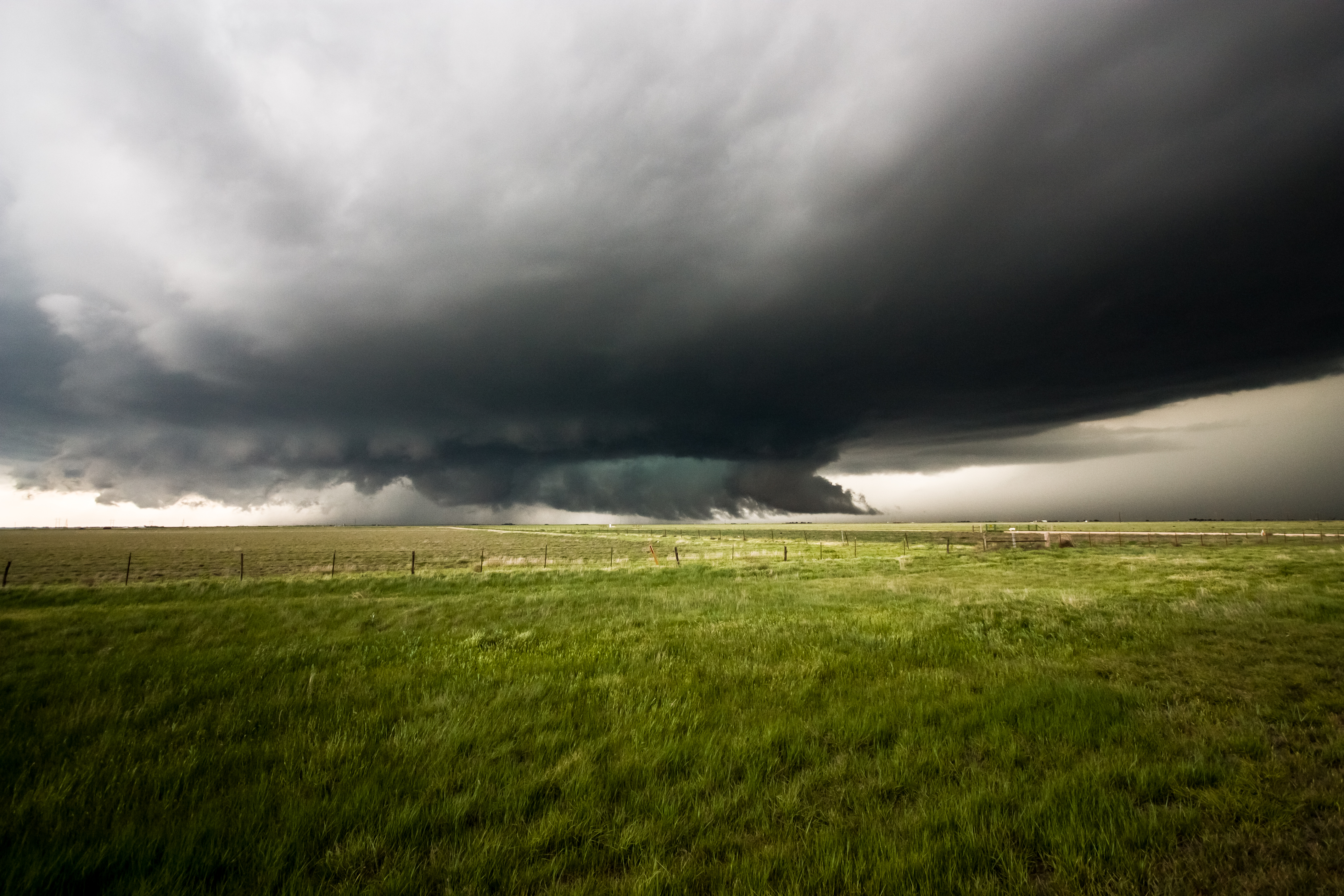
Cheyenne County Supercell
Powerful low precipitation supercell in Cheyenne County Nebraska
Welcome to my home on the web! I’m a storm chaser based out of Vaughan, Ontario, Canada and actively chase both locally in Southern Ontario and in the great plains of the U.S during the spring and summer.